Nature is the fountainhead, the source from whence all originally must spring: John Constable
Water sources:
Atmosphere – 00.001 %
Lakes and Rivers: 00.009 %
Underground; 01.05 %
Ice caps and Glaciers; 02.14. %
Seas and Oceans: 95.8 %
Though constituting only 00.009 % of the total water available in the world, Rivers and Lakes, Springs from nature are the greatest contributions of the unknown to mankind.
Most of the ancient civilisations rose and perished for more than one reasons. Even today river systems formed millions of years ago, playing an enviable part in the social and economic life of man.
Next only to the air to breathe, mankind acutely needs water to survive. Almost all the major cities of the world are situated on the banks of the rivers or the seashores. Owing to road and rail transportation, river navigation is almost reduced to nothing. Still, the cheapest and the highest international transportation is through seas.
“Theory of gravitation explains as to how the planets revolve, and how they are maintained in their orbits. But it does not tell us what is the cause of the origin and the movement of the sun, the moon, and the stars.” (Isac Newton).
Same is the case with the rivers. For example, Hundreds of small and big rivers rise at the Western Ghats, known as the Sahyadri Hill range. For example, the Kaveri, Krishna and the Godavari originate, respectively at Talakaveri in Kodagu District, Karnataka and Mahabaleshwar, Satara District and Trimbakeshwar in Nashik in District in Maharashtra at a distance of less than 1000 K.ms., as the crow flies.
If they were to flow on parallel lines or in some other directions, substantial parts of South India and Maharashtra would have been arid regions.
Many of the mineral wealth in this region are found on the catchment areas of the rivers. Though it constitutes less than 1% of the total availability of water resources, enjoyment of this nature’s bounty has always been the most contentious.
Riparian states and regions, in their own way, lay claim over the utilisation of its resources, particularly waters. There is nothing wrong with being self-supportive. But must be aware that; “Your liberty to swing your fist ends just where my nose gegins”. (Oliver Wendell Holmes, Jr)
Reference is to the Krishna river, which originates in the Western Ghats near Mahabaleshwar at an elevation of about 1,300 metres in the state of Maharashtra in central India.
After the Brahmaputra, the Ganga and the Godavari, the Krishna is the fourth-biggest river in terms of water inflows and river basin area in India. The river is almost 1,300 km long. It is one of the major sources of water for drinking, irrigation, electricity generation, industrial and other purposes in Maharashtra, Karnataka, Telangana and Andhra Pradesh.
The Krishna, along with its tributaries is also exploited to the fullest extent possible.
The dispute over the available, allocable, allotted and surplus water is perennial. The latest is Telangana’s objection to Andhra Pradesh’s right over Krishna waters from Srisailam dam. It does not mind the water going to the Bay of Bengal, but not to be utilised in AP to cultivate the parched lands and quench the thirst. I do not like to disturb the readers with the arithmetical jugglery and statistical boredom. I put forth certain facts to defend the move of the Govt of AP and the demand of the people of Rayalaseema to increase the capacity of the Pothyreddypadu Head Regulator (PRPHR) and demand to locate the Office of the Krishna River Management Board (KRMB) at Kurnool.
KC Kalkura
Telangana was nowhere in the picture when the Srisailam Project was conceived, planned, designed and executed. In fairness, the Nizam’s Govt had a role in the Tungabhadra Project at Hospet and now and then raised the subject of Nandikonda (present Nagarjunasagar) Project.
Telangana govt is speaking a transparent lie that the Nizam’s govt secured the clearance for the Nandikonda Project.
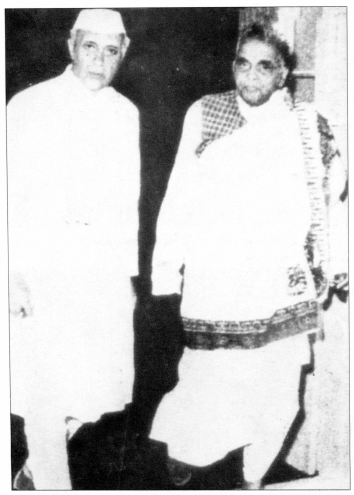
prakasam Pantulu with Prime Minister Nehru
Prakasam Pantulu’s Autobiography gives a graphic account of the strain taken in 1953-’54, by the short-lived Prakasam’s Cabinet to get the concurrence of the Central Govt and the clearance from the Planning Commission. A dam across the Krishna in Kurnool district at Siddeswaram, with lesser cost and submersion, was a dream of the Rayalaseema people from about 1850s. Owing to the objections from the lower riparian regions, the project was shifted to Srisailam as a Hydro Electric Project. The original plan was only the Right Bank Power House with 7 X 110 = 770 Megawatts. As it was felt that during the flood season, the water was underutilised, through the only powerhouse, a left bank Powerhouse with 165 X 6 =990 Megawatts capacity was constructed. It was an afterthought. Ever since the project was started, there has been vocal and active agitation in Rayalaseema to convert it into a multipurpose one. The demand is to allocate the allotted water and utilise the surplus in the lower regions as there is a large variation in the percentage of irrigated areas between Telangana, Rayalaseema and Coastal Andhra. Owing to the Srisailam Project, many villages with fertile lands were submerged and inhabitants for centuries were dislocated in Kurnool Dist; of course to a lesser extent in Mahaboobnagar Dist also. The Andhra Pradesh Government insisted on an open canal system to carry the allotted 15 Tmcft of drinking water to Chennai; hence the Telugu Ganga.
Telangana must bear in mind that the work on PRPHR to draw water was commenced in 1981 by the Chief Minister, T Anjaiah, a Telangana leader; might be for a lesser capacity. Capacity was increased to feed other schemes like Galeru Nagari Srujala Sravanti Scheme (HNSSS), Srisailam Right Branch Canal (SRBC) and to supplement the assured water to K.C.Canal. It was also intended to draw the maximum possible surplus during the flood season.
Later Srisailam Left Branch Canal (SLBC) was also dug. All the bonanza was showered on Telangana in combined State when Andhra leaders were Chief Ministers. If ultimately the Project is recognised as a Multipurpose one, it is the result of the relentless fight by the hungry and thirsty Rayalaseema farmers.
Telangana has no manner of right to object to the Rayalaseema needs. Originally the Srisailam Project was planned to a height of 900′. A Hydroelectric Project, impounding more water would be beneficial to the lower regions. So they raised no objection. There was a possibility of clearance from the Planning Commission also. However it would inundate a portion of Kurnool Town, the height was reduced to 885 feet. Had it been 900′, it would have stored another 100 tmcft of water and the possibility of Jurala was ruled out.
Yet pathetically the position of Rayalaseema is:
Upon a painted ocean,
Water, water, everywhere,
And all the boards did shrink;
Water, water, everywhere,
Nor any drop to drink.” (Coleridge, Rhyme of the ancient mariner.)
Turning to the next issue, KRMB Office, Kurnool is the most suitable place in the entire stretch of 1,300 k.ms., and a basin extending over an area of 2,58,948 sq k.ms which is nearly 8% of the total geographical area of the country.
Kurnool is about 500 K.ms from Hamsaladeevi and about 800 k.ms from Mahabaleshwar. Kurnool has all the means of transport, Rail, Road and Air. (The Orvakal Airport, 20 k.ms. from Kurnool is ready for operation in Oct.2020.)
It is almost at the centre of most of the important and major dams in the basin; Koyna, Ujjain, Alamatti, Narayanapur, Hospet, Jurala, Srisialam, Nagarjunasagar and Prakasam Barrage. There have not been proper and comprehensive studies of the river basin.
Rayalaseema University in Kurnool and the prestigious autonomous technological like G.Pulla Reddy, Pullaiah and Rajiv Gandhi Engineering Colleges in the district with advanced research facilities will be pleased to start new courses based on the river resources.
Agricultural College in Mahanandi and the international-fame Regional Agricultural Research Station,(RARS) Nandyal are equipped with the know-how to upgrade the agro-diversity in the catchment areas and the basin.
Nallamala Forest Range in the District possesses one of the richest flora and fauna in South India. Atmakur is eminently suited to make exhaustive studies on the subject.
The Potti Sriramulu Telugu University Centre at Srisailam, for History, Archaeology and Culture can be entrusted to exploit the thinktank in the Basin. “A good river is nature’s life work in song.”